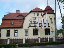
 Asset Publisher
LOCATION

 nadleśnic.jpg
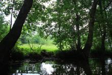
 Położenie, fot. Paweł Pochocki
The Forest District Inspectorate Świebodzin is a part of Regional Directorate of the Sate Forests (RDLP) in Zielona Góra.
The forest area located in the northern part of RDLP Zielona Góra, it ranges approximately between 15o10" and 15o42' of the eastern longitude, and between 52o09" and 52o24" of the northern latitude. From the north, the Forest District borders with the Forest District Sulęcin, Międzyrzecz and Trzciel (RDLP Szczecin),from the east with the Forest District Sulechów, from the southern – west with the Forest District Bytnica, and from the west with the Forest District Torzym (RDLP Zielona Góra).
According to Natural Forest Regionalization on the ecological and physiographique basis(National Agricultural and Forestry Publishing House –PWRiL Warszawa 1990) the forests of the Forest District are entirely located in the III (third) Wielkopolska and Pomerania Natural Forest Province, in the 6 District of Lubuskie Lake District, in the mesoregion of Lubuskie Land (also called Lubusz Land – III.6.a). In respect of hydrography, they are located in Baltic Watershed, in the River Odra basin.
The grounds of the Forest District Świebodzin are located within the areas of Lubuskie Province in Sulęcin District (in the communes of Sulęcin and Torzym) and in Świebodzin District (in the communes ofLubrza, Łagów, Skąpe, Szczaniec, Świebodzin) and within the town Świebodzin.
The Forest District consists of three sub – districts:
- Łagów, with its area of 8 701,17 ha,
- Ołobok, with its area of 7 544,90 ha,
- Świebodzin, with its area of 7 749,79 ha.
The overall area of the Forest District equals 23 995,86 ha, and its territorial range of its management equals 56 529 ha.