
Zanocuj w lesie
Nadleśnictwo Świebodzin wyznaczyło specjalne obszary leśne o łącznej powierzchni 1519,83 hektara, gdzie miłośnicy bushcraftu i survivalu mogą uprawiać swoje hobby bez obaw naruszenia prawa - ustawy o lasach. Wyznaczone przez Nadleśnictwo Świebodzin strefy, to obszary przeznaczone dla miłośników bushcraftu i survivalu, ale również dla ludzi chcących przenocować „na dziko” w lesie, bez jakiejkolwiek infrastruktury turystycznej.
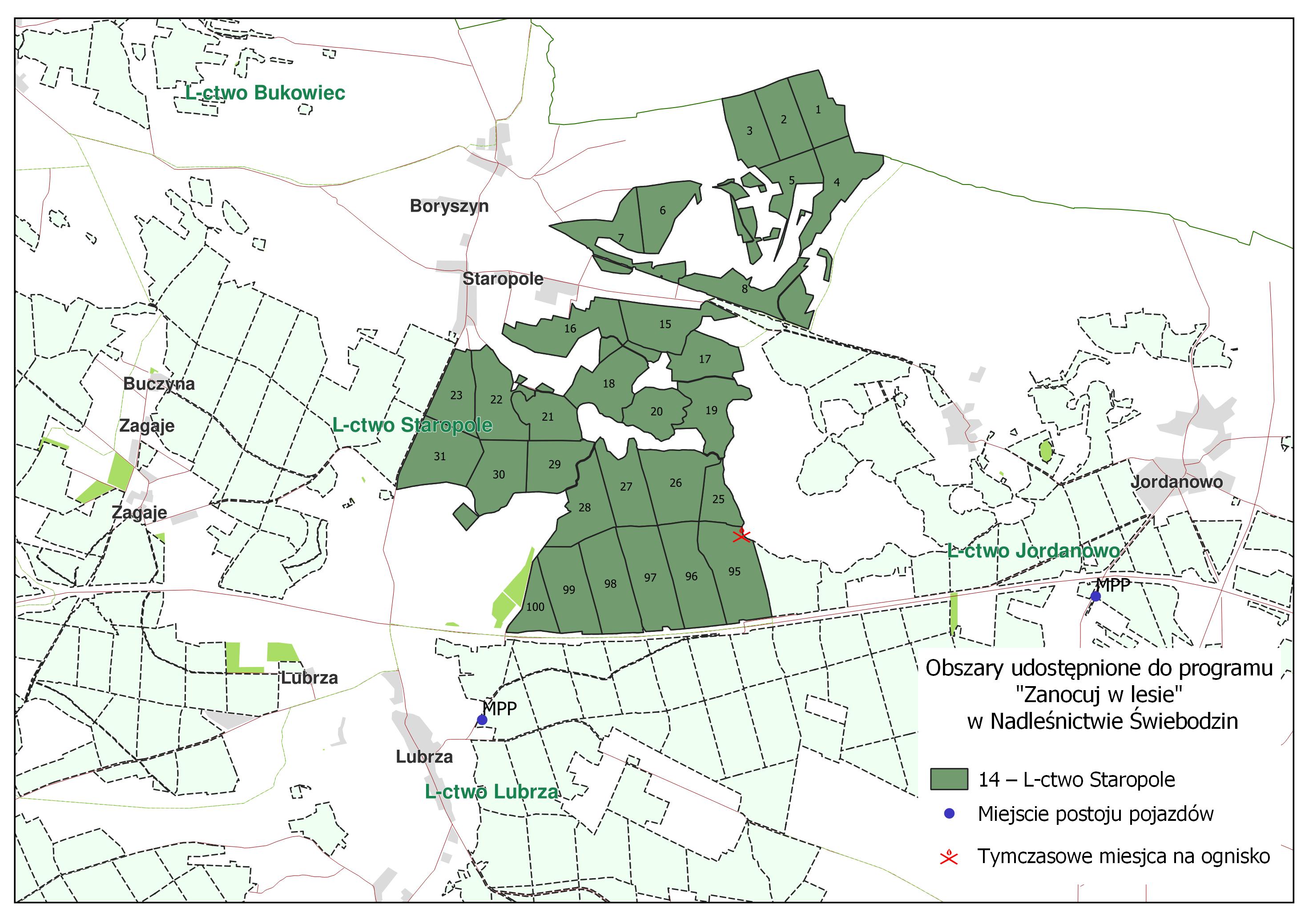

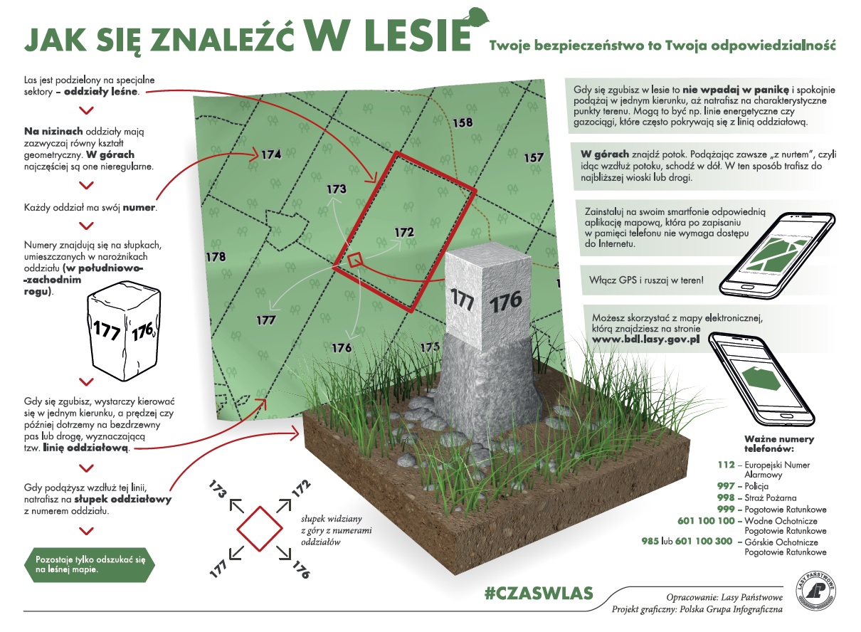
Lokalizacja widoczna jest również na mapie BDL (https://www.bdl.lasy.gov.pl/portal/mapy) oraz z poziomu aplikacji Mbdl na Androida (https://play.google.com/store/apps/details?id=pl.gov.lasy.bdl) lub na iOS (https://apps.apple.com/us/app/mbdl/id1388815663), z menu wybierz – mapy BDL – mapa zagospodarowania turystycznego (dostępna od 1go maja).
Zanim udasz się na wyprawę zapoznaj się z:
1. Regulaminem korzystania z obszaru [regulamin].
2. Informacjami, gdzie wyznaczone są miejsca do rozpalenia ogniska i czy te są zaopatrywane w drewno i na jakich zasadach można z niego korzystać, jeśli nie, należy drewno przynieść ze sobą.
- miejsce przeznaczone do palenia ogniska – oddz. 298 a leśnictwa Chociule oraz oddz. 95 c leśnictwa Staropole.
3. Mapą okresowego zakazu wstępu do lasu [https://zakazywstepu.bdl.lasy.gov.pl/zakazy/]. Przed wyjściem do lasu sprawdź, czy obszar nie znajduje się na obszarze objętym zakazem.
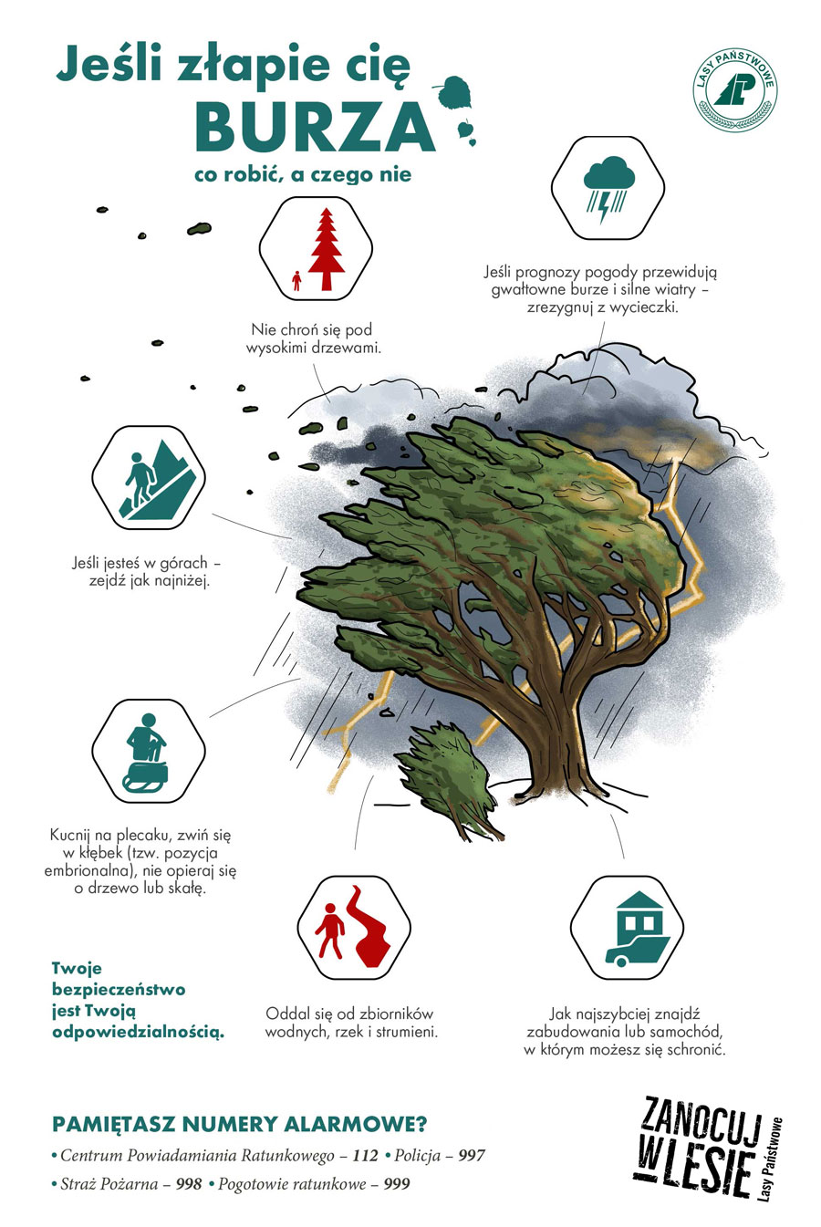
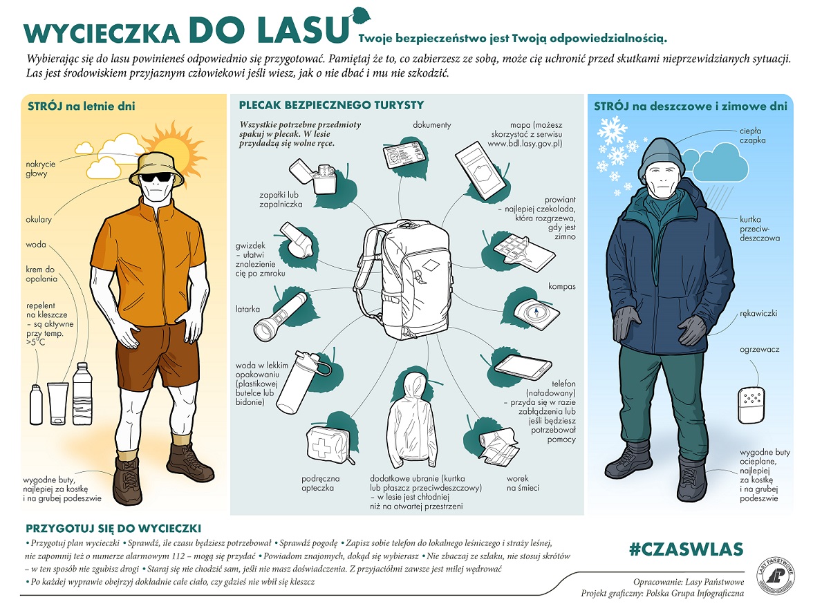
4. Zasadami bezpiecznego korzystania z lasu [https://czaswlas2.ecms.pl/bezpieczenstwo-w-lesie-i-porady-3].
5. Z informacjami, gdzie mogą być prowadzone prace gospodarcze. Na powierzchnie te obowiązuje zakaz wstępu.
6. Z czasowymi wyłączeniami /zmianami przebiegu szlaków turystycznych.
7. W okresie jesiennym i zimowym z terminami polowań zbiorowych, które koła łowieckie mają obowiązek podawać do wiadomości gmin. Na obszar na którym odbywa się polowanie, obowiązuje zakaz wstępu!
- terminy polowań zbiorowych będą podawane na bieżąco.
8. Jeśli Twój nocleg przewiduje więcej niż 2 noce lub/i więcej niż 9 osób w jednym miejscu musisz wypełnić formularz zgłoszenia noclegów i uzyskać zgodę nadleśnictwa. Zgłoszenie następuje poprzez wypełnienie formularza [formularz] oraz przesłanie go na adres: swiebodzin@zielonagora.lasy.gov.pl nie później niż 2 dni robocze przed planowanym noclegiem. Pozytywna odpowiedź mailowa z nadleśnictwa jest wyrażeniem zgody na zaplanowane noclegi.
Kontakt do koordynatora programu w Nadleśnictwie Świebodzin – Agnieszka Anklewicz – tel.: 608 586 021, e-mail: agnieszka.anklewicz@zielonagora.lasy.gov.pl.
Nadleśnictwo Świebodzin przystąpiło do Programu „Zanocuj w lesie”, który powstał w ramach kontynuacji założeń zawartych w ogólnopolskim pilotażu udostępnienia obszarów leśnych, celem uprawiania aktywności typu bushcraft i survival. Po ponad rocznym okresie trwania pilotażu, ankietowaniu osób korzystających z obszarów pilotażowych, zarządców terenu, rozmowach ze środowiskiem bushcraftowym i survivalowym wykiełkował pomysł przekształcenia pilotażu w stały program pn. „Zanocuj w lesie”.


 Asset Publisher


Asset Publisher
FORESTS OF THE FOREST DISTRICT
FORESTS OF THE FOREST DISTRICT
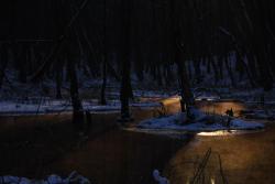 Lasy Nadleśnictwa, fot. Paweł Pochocki
 Lasy Nadleśnictwa, fot. Paweł Pochocki
 Lasy Nadleśnictwa, fot. Mariusz Grondys
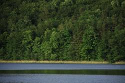
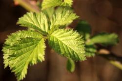
The area of the Forest District is diversified naturally. There is very rich local animal and plant world.
In the relief of the Forest District Świebodzin, there is very clear difference between the Łagowskie Lake District and the Torzymska Plain. The Łagowskie Lake District has generally got hilly and rolling landscape, with highlands in places (the Łagów Landscape Park); its true height reaches to 200 meters over the sea level (Bukowiec 225 meters). Within the area of Torzymska Plain, there predominate the lowland sandurs and the rolling lands, and their true height varies from 40 to 100 meters over the sea level.
The territorial range of the Forest District is mainly under the influence of polar and maritime climate, characterised with the humid air. During the winter time, there occur often thaws and rainfalls, the summer is cold with many clouds and often rainfalls. The winds usually blow from the west or from the southern west. However, lately, there often happen weather anomalies, namely: in winter, there are days with temperature over 10 Celsius Degrees; winters are snowless, and there sometimes occur storms. During the vegetation time, there happen long lasting droughts (May / June, July / August); Within the whole year, we can observe hurricanes.
The area of the Forest District geologically is located within the range of the North – Polish Glaciation, in the main stadial, in the Leszczyńska phase, partly also in the Poznańska and Pomorska phases. Most of the geological formations come from the Quaternary (Neogen). These are both: created in the Pleistocene glacial and sandour sands, sands and gravel of end moraines, glacial till, as well as originating from the Holocen period formations connected with mosses, rots, river sands, and fields of eolian sands covering the older formations. Ocassionally, within described area, there also occur formations from the Teritary period (Paleogen): sands, loams and brown coals, located nearby Sieniawa.
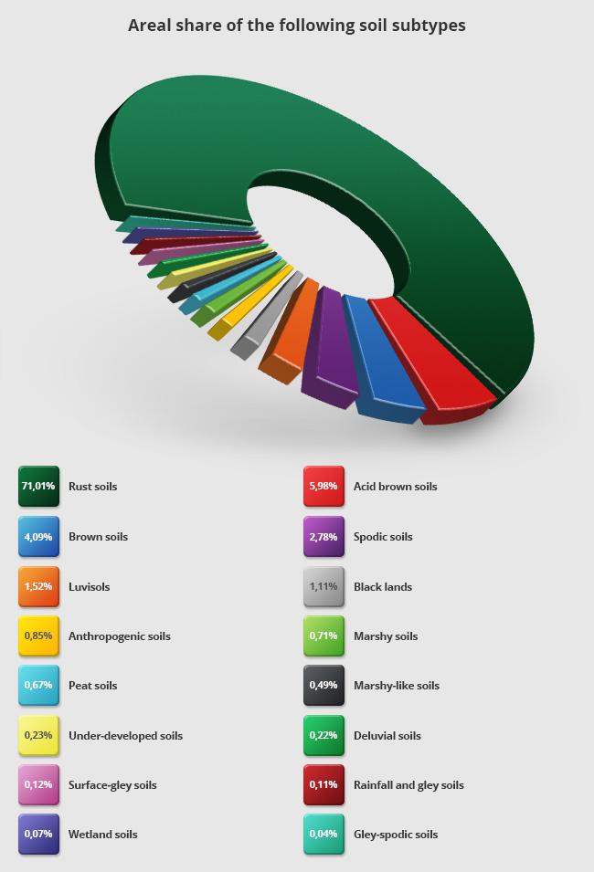
Within the area of the Forest District Świebodzin, there predominate rusty soils (71,01 %) and acid brown soils(15,98 %). The other soils cover lee than 5 % of the overall area of the Forest District.
The range of the Forest District is located in the River Odra basin, in the watershed of Warta and Odra Rivers. The water network in forests is dense and complicated. The directions of downflows run into different sides. Because of diversified relief, in many places we can meet the closed drainage areas situated on the clay or silt ground. The biggest lakes within the range , in the Warta River watershed are: Paklicko Wielkie Lake, Goszcza Lake, Lubie Lake and the River Paklica. In the River Odra watershed, ther are: Niesłysz Lake, Trześniowskie (Ciecz) Lake, Łagowskie Lake, Niedźwiedno Lake, and the River Pliszka, Channel Ołobok, Łagowa.